Around Clew Bay › Westport › In town from Westport
Westport, the town that was drawn before it was built
Before you ride out along the old railway, give the town at its start an afternoon: a river lined with trees, a market square with eight sides and a quay facing Clew Bay.
Trail noteThe greenway leaves Westport on town streets and shared paths before the old railway line takes over, so watch for traffic, junctions and pedestrians for the first stretch.
Most people meet Westport as a starting line. The greenway begins here, the bikes are fitted here, and the first few kilometres out of town are full of riders checking their saddles. It is worth slowing down before you go. Westport is one of the few Irish towns laid out to a plan, and the plan still shows: wide streets that bend to follow the land, a tree-lined river walk, a square with a column at its centre and a road running down to a stone quay on Clew Bay.
A town laid out on purpose
The town you walk through today took shape in the late eighteenth century, when the Browne family, the landlords who lived at Westport House, moved the older settlement away from their front door and rebuilt it a short distance east. The new streets were set out with care. Houses were built in terraces of cut stone and render, shopfronts faced squares and crossings, and the river was turned into the centrepiece rather than the back lane.
You do not need a map to feel it. Stand at the top of Bridge Street and look down towards the river and the hills behind, and the town falls away in a way that feels arranged. The streets are narrow by modern standards and busy in summer, so walking is easier than driving, and most of the town centre is a ten-minute stroll from end to end.
The Mall and the Carrowbeg River
The Mall is the part of Westport people remember. The Carrowbeg River runs through the middle of town between low stone walls, crossed by small bridges, with tall trees along both banks and a broad street on each side. It was planned as a promenade, and it still works as one. In the evening the water is quiet, the light comes down through the leaves and the whole length of it is a pleasant walk before or after a day on the trail.
Look at the stone walls and the weirs as you go. After heavy rain on the hills the river can rise quickly and run brown and loud; on a dry week it is a shallow stream you can hear more than see. Either way, the Mall is the easiest landmark in town. If you lose your bearings, find the river and follow it.
The Octagon
Up the hill from the Mall, the Octagon is the old market square, an eight-sided space with a tall stone column in the middle. The column has had more than one figure on top over the years, and today it carries a statue of Saint Patrick, a nod to the mountain that rises over the bay to the south-west. Market days have long been held here, and the square still fills with stalls on some days of the week; days and times change.
The streets that run off the Octagon are where you find most of the town's everyday life: hardware, groceries, chemists and bakeries, and the places that sell rain gear to people who arrived without it. It is a good place to pick up food for the trail before you leave in the morning.
Off the trail: The Great Western Greenway, end to end
Down to the quay
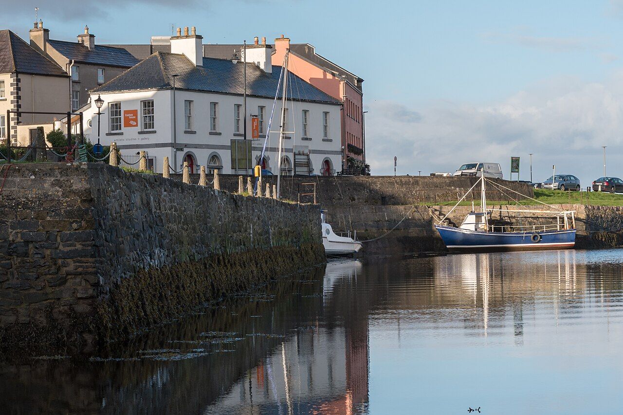
Westport began to look outward to the sea when it was rebuilt, and the quay is where you see that ambition. It sits a little way west of the town centre, a walk of half an hour or so along the road or a short spin on a bike. The old stone warehouses along the waterfront were built for grain and trade in the days when ships came in from Clew Bay. Many have been converted to homes and other uses, but the long stone fronts and the quay walls still give the place its character.
At low tide the inner harbour drains to mud and weed, and the boats lie on their sides. At high water the stone walls drop straight into the sea and the reflections are clean. Across the water to the south-west is the cone of Croagh Patrick, and on a clear day you can follow the line of the mountain from the quay all the way along the bay. If you want more on the mountain, read about the holy mountain seen across the water before you head out.
Westport House and its grounds
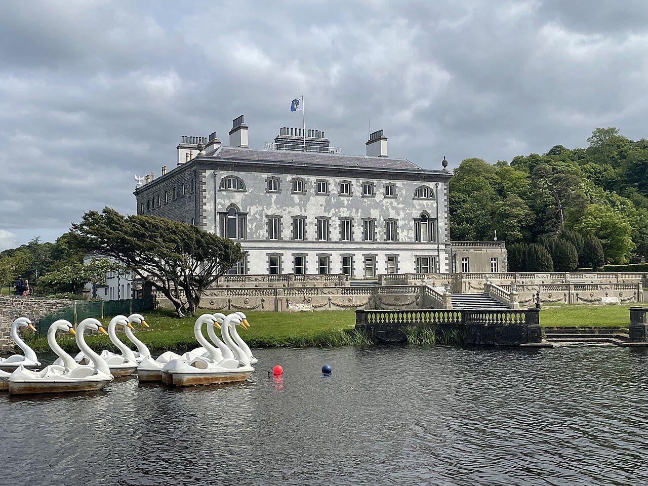
Between the town and the quay lies Westport House, the Browne family home for centuries and the reason the town was moved in the first place. The house is a large Georgian building of grey stone, set in parkland that runs down to the water. It is often said to stand on the site of an older tower house linked with the O'Malleys, the sea-going family of Clew Bay, and the story of Grace O'Malley is one the house has long told.
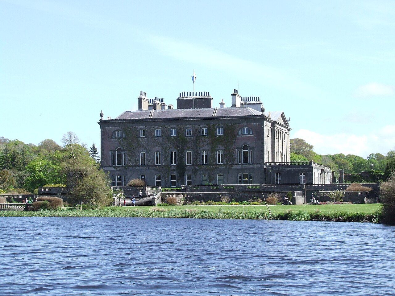
The grounds have changed hands and uses in recent decades, and what is open to visitors, and when, has varied. The parkland, the lake in front of the house and the woodland paths are the parts most people come for.
Using Westport as a base
Westport is a natural base for the trail. It has the train station, the most buses and the widest choice of places to stay and eat, and it makes a good point to return to at the end of a day. Many people ride the first stage out to Newport and come back the same way, or take a bike shuttle back from further along. Others start here and go straight through to Achill over one or two days.
If you are arriving by train, the station is close to the town centre and a short walk from the Mall. For details on rail, bus and airport links, the guide to getting to Mayo and the trail covers the options in general terms.
A few practical points
- The town is busiest in July and August and on festival weekends; spring and early autumn are calmer.
- Parking in the centre is limited at busy times, so walk in from where you are staying if you can.
- The river walk and the quay road are both easy on foot; the hill up from the Mall to the Octagon is short but steep.
- Rain comes and goes quickly here. A light shell in your bag saves you sheltering in doorways.
Give the town one slow evening, walk the river and the square, and look out from the quay at the mountain you will be riding beside the next day. The greenway will still be there in the morning.
Next note: Rockfleet and Burrishoole, stone and tide west of Newport